
Copyright © 2024
Rockhaven Resources
All rights reserved.
Rockhaven Resources
All rights reserved.
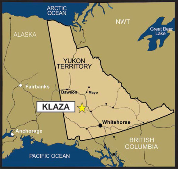
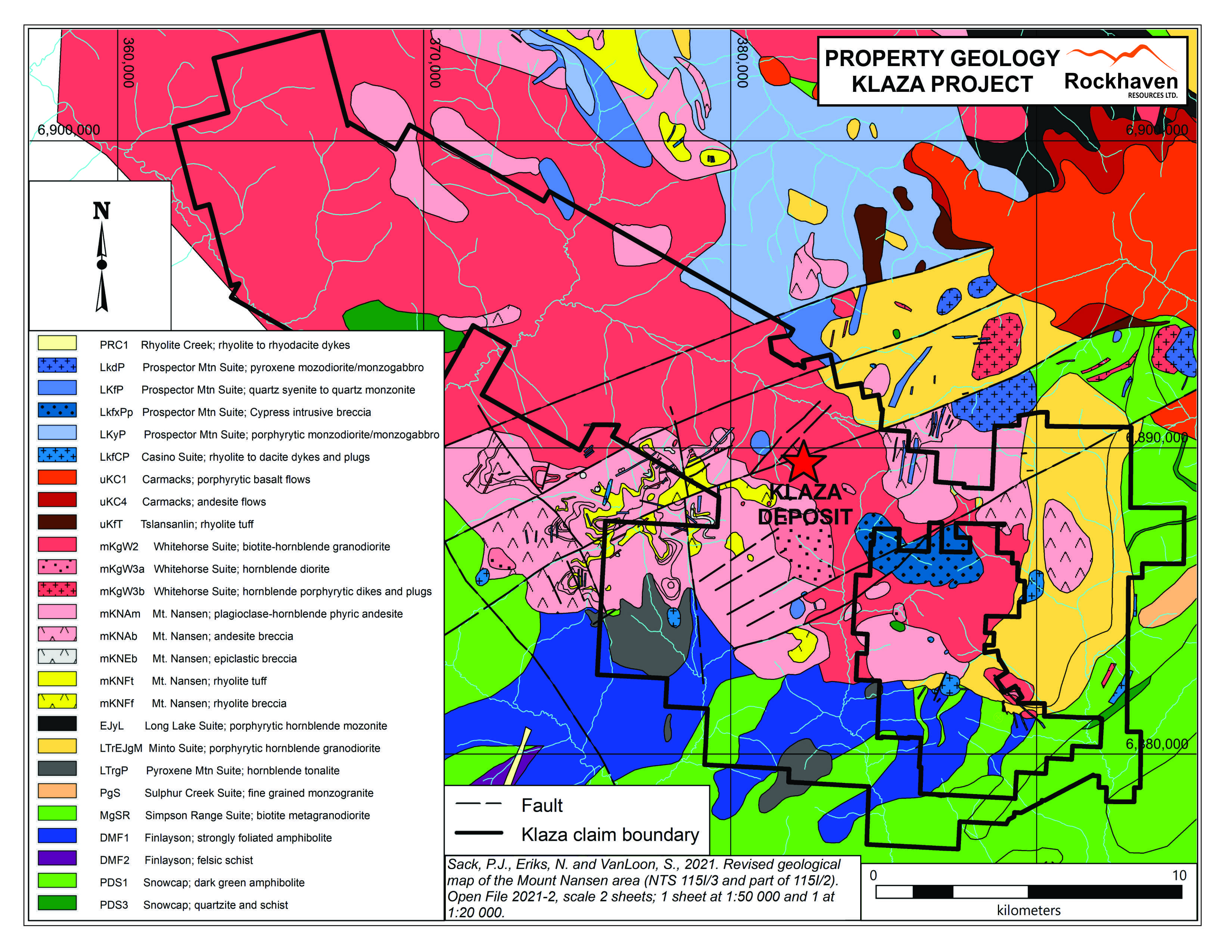
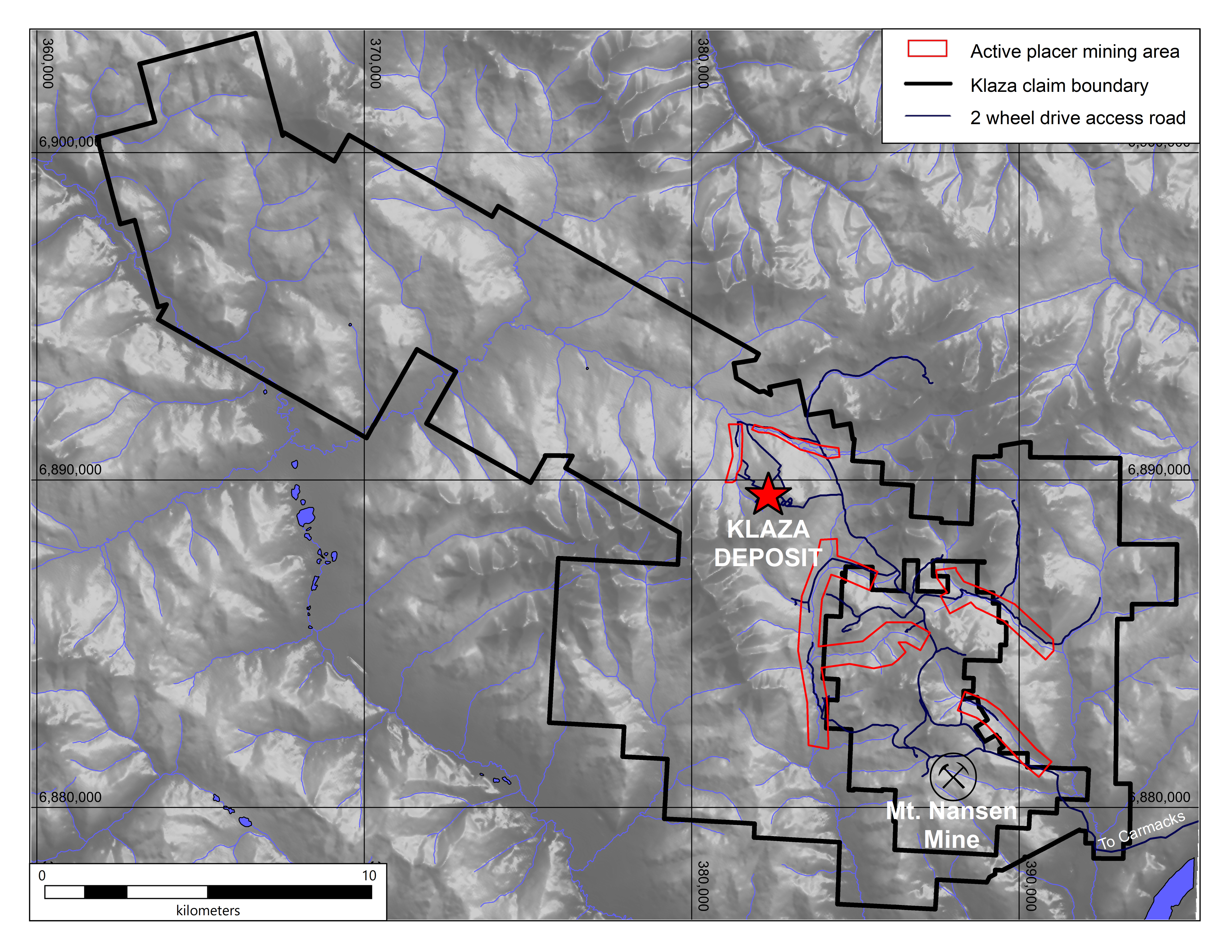
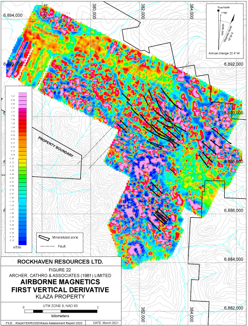
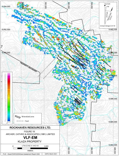
The Klaza Property is 100% owned by Rockhaven Resources Ltd. and covers an area of 25,000 hectares, 50 km west of Carmacks. It is favourably located within the southern part of Yukon’s Dawson Range Gold Belt, an under explored area that hosts a historical gold mine, rich placer gold deposits and key infrastructure such as road access.The Klaza property is road accessible by a two-wheel drive road from the Klondike Highway. Rockhaven’s exploration to date has included over 100,000 m of diamond drilling, 24,500 m excavator trenching; airborne and ground magnetic, radiometric and VLF-EM surveys; and extensive soil geochemistry.
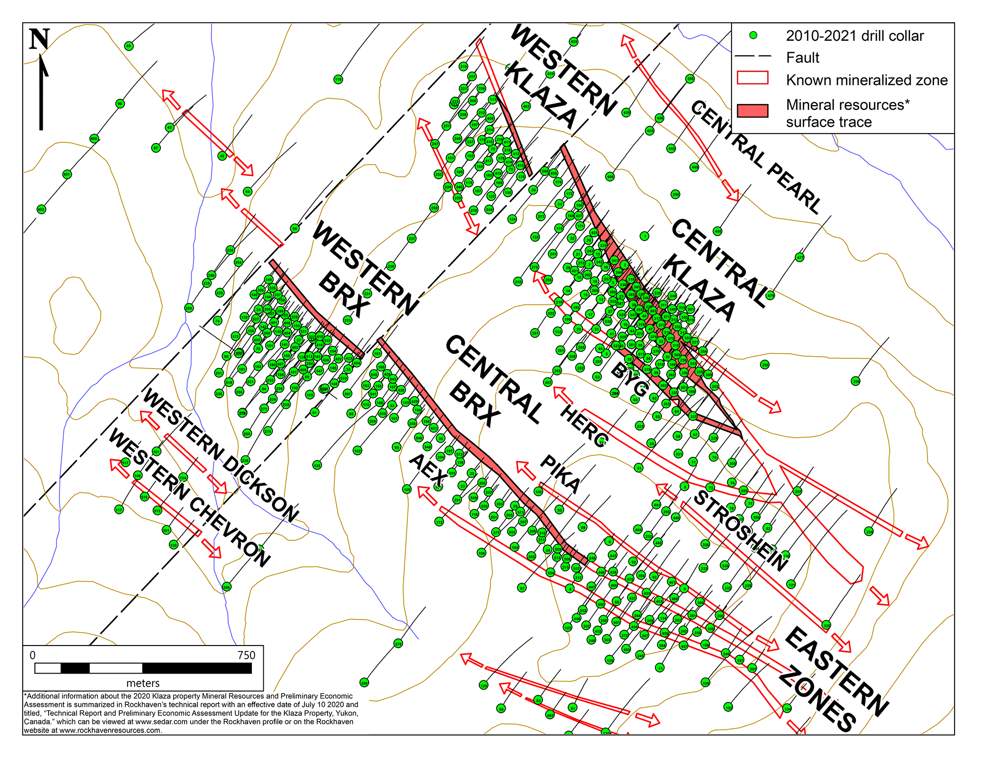
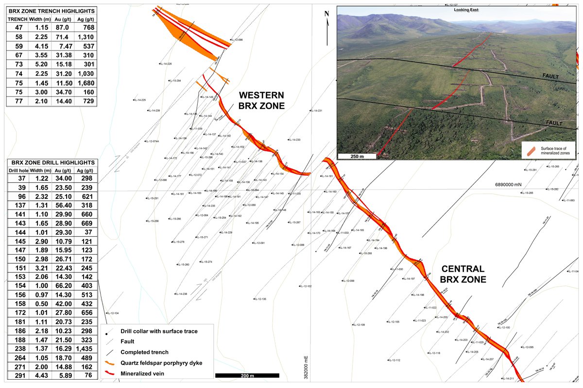
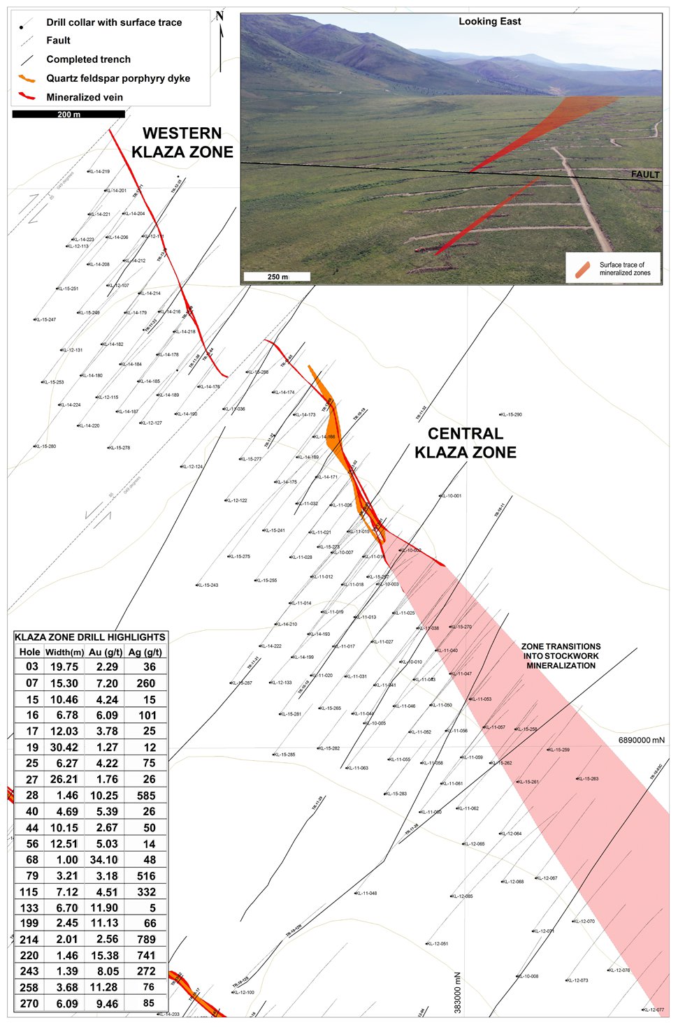
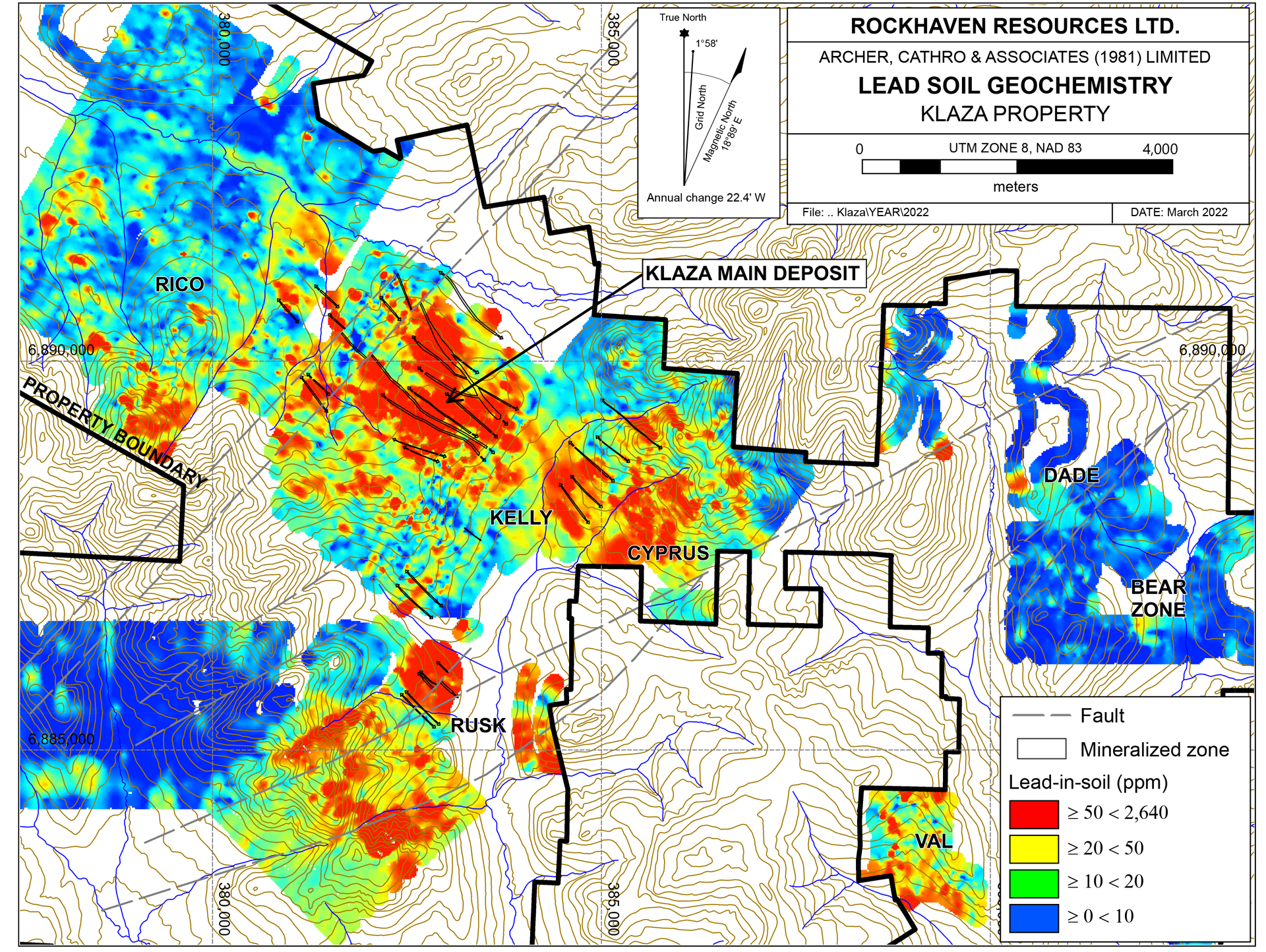
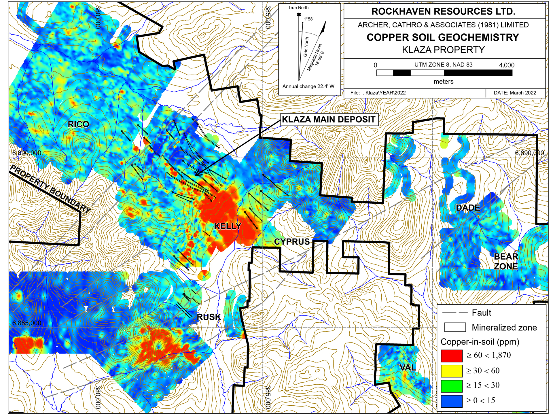
Drilling at the Klaza property has identified 12 main mineralized zones and numerous subsidiary structures which have a cumulative mineralized strike length greater than 10 km. The zones are hosted within a 1.8 km wide structural corridor consisting of Mid-Cretaceous granitic country rocks. Individual zones range from 1 to 75 m in width and consist of quartz-sulphide veins, breccias and fracture networks that are spatially associated with unmineralized quartz-feldspar porphyry dykes. They exhibit exceptional lateral and down-dip continuity, and all zones remain open for extension along strike and to depth.
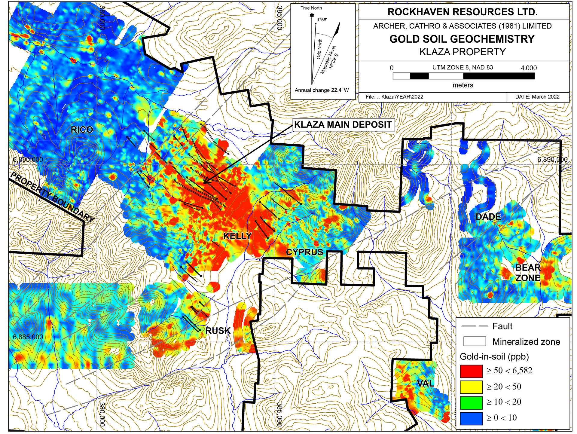
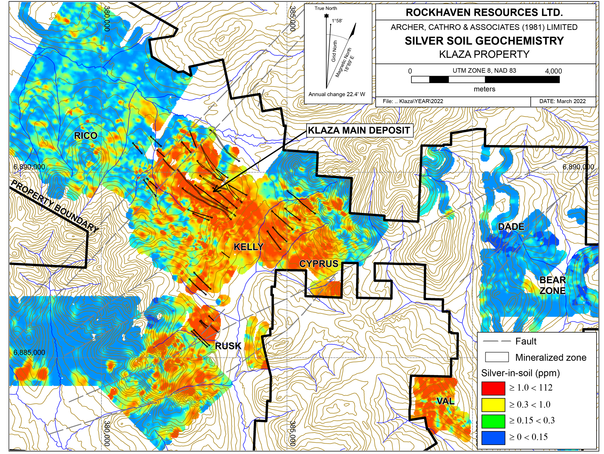
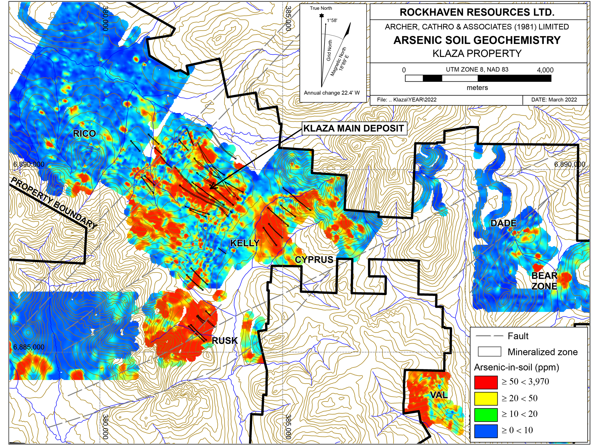
The mineralized structural zones correlate well with intense magnetic lows and VLF-EM conductors that are often accompanied by anomalous gold, silver, lead, zinc and arsenic soil geochemical results. Follow up of some of the geophysical and soil geochemical anomalies continue to result in new discoveries.
An updated PEA was completed in July 2020 and has demonstrated the excellent economic potential of the Klaza Project.At a base case gold price of US$1,450/oz gold, the Klaza project has a Post-Tax NPV(5%) of $378 million and an IRR of 37%.At current prices (US$1,740), the project has an exceptional value of post-tax NPV(5%) of $540 million and IRR of 49%.The following tables summarize the results of the updated PEA and its sensitivities.
An updated Mineral Resource was prepared by AMC Mining Consultants (Canada) Ltd. and announced on June 21, 2018 and forms the basis of the 2020 updated PEA. Results of this Mineral Resource estimate are summarized below.
Table 1: Mineral Resource Estimate Summary, June 5, 201811,5
|
Tonnes |
Grade |
Contained Metal |
|||||||||
|---|---|---|---|---|---|---|---|---|---|---|---|
|
Au |
Ag |
Pb |
Zn |
AuEQ4 |
Au |
Ag |
Pb |
Zn |
AuEQ4 |
||
|
(kt) |
(g/t) |
(g/t) |
(%) |
(%) |
(g/t) |
(koz) |
(koz) |
(klb) |
(klb) |
(koz) |
|
|
Indicated3 |
4,457 |
4.8 |
98 |
0.7 |
0.9 |
6.3 |
686 |
14,071 |
73,268 |
92,107 |
907 |
|
Inferred3 |
5,714 |
2.8 |
76 |
0.6 |
0.7 |
3.9 |
507 |
13,901 |
77,544 |
89,176 |
725 |
Investors should be cautioned that the preliminary economic assessment is preliminary in nature, that it includes inferred mineral resources that are considered too speculative geologically to have the economic considerations applied to them that would enable them to be categorized as mineral reserves, and there is no certainty that the preliminary economic assessment will be realized.
Technical information in this summary has been approved by Matthew R. Dumala, P.Eng., a geological engineer with Archer Cathro and qualified person for the purpose of National Instrument 43-101.